

Lidar is increasingly being used in autonomous systems and robots. The technology makes it possible to perceive the environment in 3D and detect objects accurately. This is valuable for machines that need to navigate, recognize obstacles, or map their surroundings. By looking at applications outside the agricultural market, new ideas emerge on how sensor technology like lidar can add value to agricultural machinery.
Agricultural machinery can navigate more safely, avoid obstacles, and better understand their surroundings with the application of lidar. This also applies to situations with mud, vibrations, and varying light conditions. By learning from applications in other sectors, new ideas emerge for practical lidar applications in agriculture. We utilize robust Ouster lidars, which perform well under harsh conditions.
Challenges in the Agromarket
Sensor integration in agricultural machinery presents a number of typical challenges:
- Dust and dirt
- Strong vibrations, for example, from moving machinery
- Weather influences such as rain, sun, and temperature fluctuations
- Complex and irregular objects, such as crops, bales, or animals
- Dynamic environments, such as with people, animals, or other machines on the farm
Sensors must therefore not only be accurate, but also robust and reliable in harsh conditions. These are precisely the conditions that many autonomous systems in other sectors also have to deal with.
3 practical examples of lidar applications
Example 1: autonomous robots
Trombone develops autonomous electric street sweepers that clean streets independently. For navigation and obstacle detection, these machines use lidar sensors.
The challenges of an autonomous street sweeper overlap with autonomous applications in the agricultural sector. For example, the machine must continue to function reliably in an environment with a lot of airborne dirt, varying weather conditions, and complex objects such as curbs, vehicles, and pedestrians.
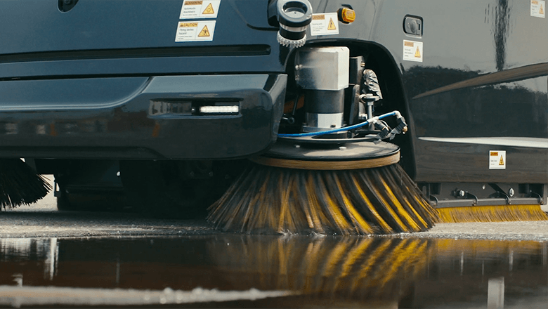
In this application, Ouster's digital lidar continuously creates a 3D image of the surroundings. This allows the machine to detect obstacles and navigate safely.
Because lidar is an active sensor with its own light source, it also works in the dark without additional lighting. In situations with dust or varying light – where cameras struggle – lidar continues to function reliably.
In autonomous agricultural applications, a machine must be able to recognize obstacles, navigate safely around objects, and remain reliably functional in dusty and dirty environments. In agriculture, this translates to, for example, the applications listed below:
- Feeder robot in a barn, that autonomously drives along fences and feeding places
- Field robot that navigates autonomously between crop rows
Example 2: Autonomous Off-Road Vehicles
Forterra is developing technology that enables defense vehicles to drive autonomously in challenging off-road environments. This includes terrain without lanes, with low visibility, bad weather, and limited GPS. Their systems ensure vehicles remain safe, stable, and reliable under these harsh conditions.
Lidar is one of the most important sensors in Forterra's solutions. It provides a continuous and accurate 3D image of the environment, all around the vehicle. With the digital lidar sensors, distances and obstacles are accurately measured. This allows these autonomous vehicles to drive safely, without lanes or fixed reference points.
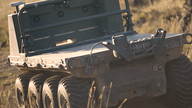
In environments where visibility and GPS are less reliable, LiDAR continues to function well. This allows vehicles to navigate safely in complex and unpredictable situations.
Similar challenges exist in agriculture, such as off-road navigation, changing weather, and pollution. Autonomous solutions help address staff shortages, for example:
- Autonomous tractors
- Unmanned field robots
- Other vehicles that operate autonomously in fields and meadows
Example 3: Mapping with Drones
Deep Forestry develops autonomous inspection drones that scan and map complex environments using lidar.
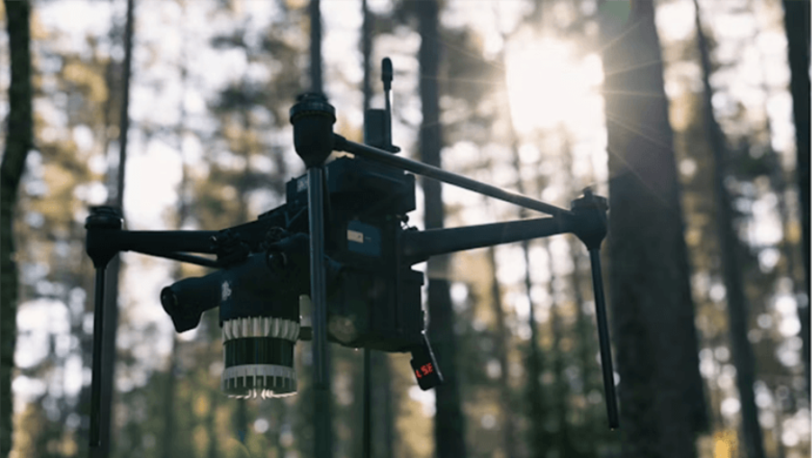
This drone uses an Ouster lidar system to create a 3D map of the forest. The system determines the distance to each tree and surface, thus generating a detailed point cloud of terrain and vegetation.
In agriculture, LiDAR can be used in a similar way as in forestry: it creates a precise 3D image of the terrain and crops, enabling analyses and smart applications, for example for precision agriculture. Examples of agricultural applications include:
- 3D mapping of fields for overview and planning
- Volume measurements of crops or harvested products
- Analysis of terrain structure and vegetation for better crop insights
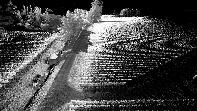
A point cloud image generated by a lidar sensor. The environment is visible as thousands of measurement points that together form a 3D image. This is what lidar ‘sees’: an accurate 3D representation based on distance and reflection. Objects such as walls, vehicles, and obstacles are visible as distinct shapes in the point cloud.
Points to consider during LiDAR integration
For OEMs looking to integrate lidar into agricultural machinery, more is needed than just placing the sensor. Lidar systems offer advantages, but success heavily depends on how they are integrated and how the data is processed. Some key considerations include:
- Mounting position
The sensor's position determines the field of view and potential blind spots. Often, lidars are placed higher on the machine for a better overview of the surroundings. - Dirt protection
Mud and water can affect the optics. Depending on the application, a protective cover, airflow, or cleaning mechanism may be necessary. - Vibrations
Agricultural machinery often produces strong vibrations. Stable mounting and vibration damping help maintain measurement accuracy. - Data processing
Lidar generates large amounts of data. For real-time applications, such as navigation, this data needs to be processed quickly by the right software.
Practical Lidar Integration with Ouster and Sentech
For the integration of digital lidar sensors Shall we work together? with our partner Ouster. Their sensors are the common thread in the practical examples from this blog.
Together, we bring technology into practice: Ouster with the hardware, and Sentech with local support and integration knowledge in the Netherlands. This is how we make the leap from sensor to working solution for machine builders.
Practical Lidar Integration with Ouster and Sentech
For the integration of digital lidar sensors, we are collaborating with our partner Ouster. Their sensors play a central role in all practical examples in this blog.
Together, we turn technology into practical applications: Ouster provides the hardware, and Sentech offers local support and integration expertise in the Netherlands. This way, we help machine builders bridge the gap between sensor and a working solution.
Besides ultrasound and radar, lidar is also increasingly being used for distance measurements and navigation applications in the agricultural sector. Lidar stands for light detection and ranging. Similar to radar, this technology also benefits from extensive miniaturization and integration down to the chip level.
While ultrasound works with sound and radar with radio waves, lidar works with light pulses. The large number of lasers on a chip creates a 3D point cloud of reflections with such high resolution and precision that the environment around the sensor can be mapped to the millimeter.
Lidar in navigation applications
Lidar is regularly used in navigation applications and functions as the eyes of an Automated Guided Vehicle (AGV), such as an autonomous agricultural vehicle. Based on all the reflections measured back by the rotating sensor system, an agricultural vehicle, for example, gets a detailed image of its surroundings, allowing it to navigate across the field and avoid obstacles.
Because lidar is incredibly fast and can also measure while in motion, the technology is suitable for accurately monitoring growth in an orchard with an AGV; useful when pruning automatically. Or, hang a lidar under a drone and map the crops from above. Although lidar's light pulses penetrate crops less effectively than radar waves, the point cloud with 5 million data points per second offers a lot of detail for measuring the ground and crop height.
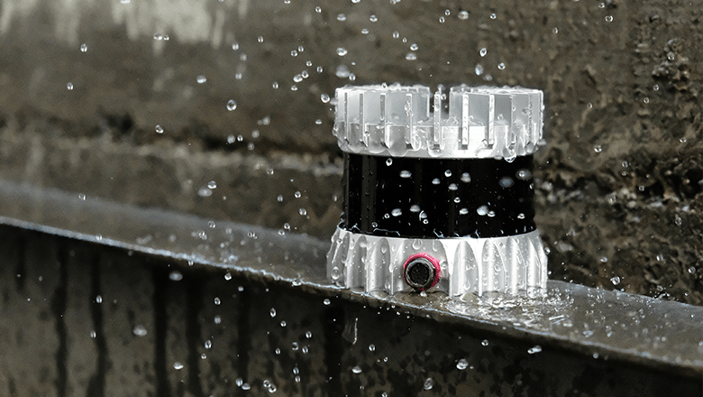
Lidar OS1 from Our technology partner Ouster provides reliable distance measurements, even under rainy and challenging conditions
If you want to measure very accurately
Lidar is much more accurate than radar and suitable for detecting objects, terrain, or crop heights down to the millimeter. It is very resistant to challenging weather conditions, dust and dirt, and very low and very high temperatures. However, lidar is quite expensive compared to radar and ultrasonic.
Examples of lidar applications
- Navigation of autonomous agricultural vehicles
- Mapping crop growth with 3D mapping
Would you like to see more concrete examples of how lidar can be applied in agriculture? In this blog we discuss three practical examples, from autonomous off-road vehicles to drone mapping. You will read how sensor technology in other sectors can offer inspiration for smart agro applications.
In use cases requiring three-dimensional environmental perception, such as navigation, object detection, or environmental monitoring, lidar is often the most suitable technology.
We have added Ouster to our technology portfolio, a respected manufacturer of digital lidar sensors for industrial automation, robotics, mobility, and smart infrastructure.
Sentech works technology-independently: the application determines which sensor best fits, and we select our technology partners based on quality, roadmap, and continuity. Ouster meets that standard.
When is lidar the right choice?
Lidar is relevant when accurate 3D data is needed in dynamic or complex environments. Consider AGVs and mobile robots that need to navigate safely, machine safety where objects at close range need to be reliably detected, or infrastructure monitoring where a complete spatial image is required.
Ouster's digital architecture is distinguished by a number of points that are practically relevant for engineers:
- High-resolution 3D imaging, useful for object detection and navigation, even at short distances.
- Robust performance in challenging conditions such as rain, dust, vibrations, or changing light conditions.
- Modular platform, the same sensors can be used in different applications without needing constant readjustments.
- Standardized interfaces and SDKs that help to quickly prototype or upgrade an existing machine.
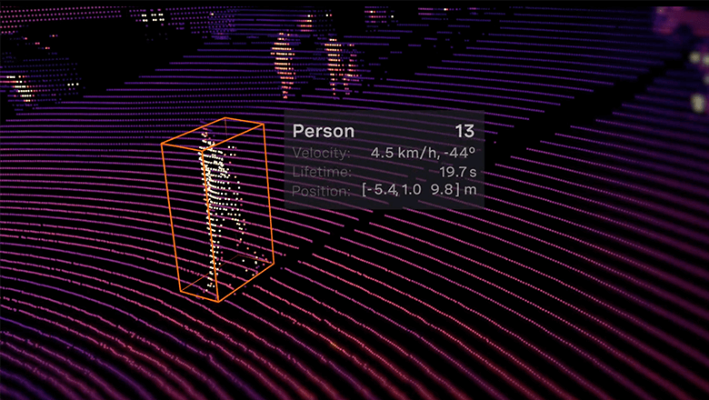
This 3D point cloud is generated by a lidar and shows thousands of measurement points that together form a 3D image of the environment. This allows machines to recognize objects and navigate safely.
Our approach is not changing
Ouster expands our technological playing field. We always start with your application: what is the measurement challenge, what are the environmental requirements, and what is the best technological choice? Sometimes that's lidar. Sometimes radar, vision, or another sensor technology. We select and build the solution entirely in-house: from engineering and (custom) assembly to validation and supply chain management.
“Ouster builds lidar sensors that perform where it counts: in complex environments, over long periods, in diverse applications. This aligns with what our customers expect from us, and what we expect from our technology partners.”
Egbert Stellinga – Product Manager, Sentech
Curious if lidar fits your application?
Are you working on a machine or system where 3D environmental perception plays a role? Then we'd be happy to discuss with you whether Ouster is the right choice, how it integrates into your system, and what that means for your development path.
Feel free to contact us.
Lidar has matured as an optical sensor technology. Although the principle is simple, it took decades to make the technology accessible to consumer and B2B markets. Thanks to chip technology, it has become an affordable technique for detection and ranging. Manufacturers of lidar technology are making the self-driving car possible. In this article, you will learn all the ins and outs of this versatile sensor technology.
Lidar has its origins in aerospace. Laser technology has long been used in aircraft for altitude measurement relative to the underlying terrain. In addition to car manufacturers, other industries are also embracing the advantages of these sensors for autonomous movement applications. For example, lidar is used in Automated Guided Vehicles (AGVs) and Autonomous Mobile Robots (AMRs).
Ad Mulders, account manager at Sentech, sees a lot of activity in the various markets. “Nowadays, lidar sensors are produced more efficiently and in larger volumes. This makes them more affordable for integration into applications.”
Mulders thinks further ahead. “We focus on integrating lidar and radar into one compact sensor module. With sensor fusion, you leverage the advantages of both detection techniques.”
History of Lidar
Lidar originated shortly after the invention of the laser, in the 1960s. During the Apollo 15 mission, it was used to map the lunar surface in detail. The term was originally a portmanteau of the words LIght and raDAR. It has since evolved into an acronym for LIght Detection And Ranging, or Laser Imaging Detection And Ranging.
Until recently, optical technology was primarily used for atmospheric and meteorological research, and applied in aerospace. As the technology has become increasingly sophisticated and inexpensive, other industries have also embraced it for autonomous motion applications.
Lidar is a remote sensing method that uses light in the form of a pulsed laser to measure variable distances to the Earth. It can be used to make digital representations of physical surfaces and objects.
The principle of lidar is simple. The optical measuring technique is used in two ways. As time-of-flight lidar, to determine the distance to an object; and as Doppler lidar, to determine the speed of objects. The operation is similar to radar, which works with radio waves. Light has a much smaller wavelength, allowing lidar to detect and scan smaller objects.
The emitted light is reflected by the target. The time between transmission and reception is used for distance measurement.
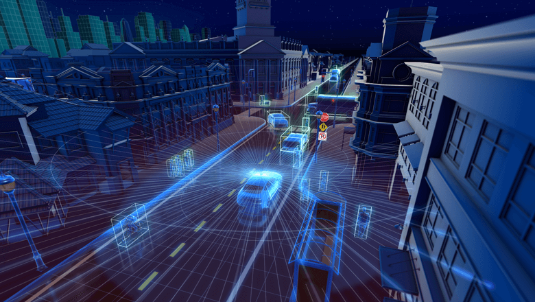
Furthermore, the target changes the properties of the emitted light, depending on its material composition and speed. This provides a lidar instrument with information that can be used, among other things, to determine the composition and speed of the object.
Lidar uses infrared, visible, or ultraviolet light to scan objects. It can detect a wide range of materials and objects. These include metallic and non-metallic objects, aerosols, clouds, chemicals, rain, stones, and even a single molecule.
The wavelengths of the light sources vary depending on the target. The spectrum extends from 10 micrometers (infrared) to approximately 250 nanometers (ultraviolet). The emitted light is reflected by scattering.
Distance measurement with lidar
The time-of-flight principle is used to determine the distance between the lidar instrument and an object. A transmitter emits light pulses. A receiver measures the duration between the transmission and reception of reflected photons.
According to the formula: d = (c × t) / (2 × n). ‘D’ stands for distance in meters, ‘c’ for the speed of light in a vacuum, ’t’ for the duration in seconds, and ‘n’ for the refractive index of air.
Speed determination with lidar
With lidar, it is also possible to determine the speed of a moving object. The instrument uses the Doppler effect. The physical phenomenon arises when a source (or receiver) of waves moves relative to a medium.
For light sources, the following formula applies: v=(T1/T2-1) × c/n. ‘T’ stands for the wave periods.
More information about the target
More recently, there are advanced lidar applications for atmospheric research. The change in the composition of reflected light provides information about the target. These applications measure air pollution, for example, based on the absorption of light by molecules. This type is also known as DIAL (Differential Absorption Lidar).
How does lidar work?
Broadly, lidar can be divided into two detection methods: incoherent or direct energy detection, and coherent detection. Incoherent systems measure changes in wave height (amplitude) in the reflected light. Coherent systems measure differences in wavelength (phase) and are suitable for speed measurement.
Light Pulse Systems
There are two systems for generating light pulses: micro-pulse systems and high-energy systems.
Micropulse systems generate intermittent energy beams. They have emerged thanks to advancements in laser technology combined with the ever-increasing processing power of microprocessors. These systems use significantly less energy, making them safe for humans and animals.
The powerful high-energy systems use much more energy and are primarily used for atmospheric research.
Lidar sensor components
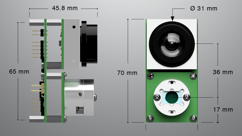
A lidar sensor essentially consists of four parts.
- Light source
This could be a laser, LED, or VCSEL diode, which emits light in pulses. - Scanner in optics
These components guide the light outwards—for instance, via an oscillating mirror and/or (aspherical) lens. A lens bundles the reflected light to a photodetector. - Photodetector in electronics
Depending on the measurement objective, the light is captured by a photodetector, for example, a solid-state photodiode. Electronics process the image data digitally. - Position and navigation system
Mobile lidar systems need a GPS system to determine the exact position and orientation of the sensor.
The different lidar systems have a similar output in common. This is a 3D point cloud that can be projected onto a map or a moving image. The sensor thus generates a detailed image of its surroundings, but can also provide additional information about those surroundings.
There are also lidar systems that are purely intended for detection and distance measurement. Manufacturers such as Velodyne and Leddartech have perfected and refined this specialty, making them suitable for lidar drones, AGVs, and self-driving cars. More on the collaboration between Sentech and Leddartech later.
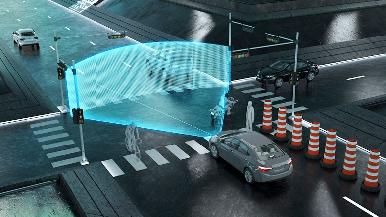
Lidar sensor applications
Lidar owes its popularity to the accuracy and high resolution with which scientists have been able to map the world, underwater, on the surface, and in the air. Until recently, it was still an expensive matter and was mainly used for research, and commercially only in aerospace.
Due to cost reduction and technological advancements – especially in miniaturization, reliability, and durability – lidar has also become accessible for a wide range of commercial applications. For example, in autonomous vehicles and robots.
Agriculture: detection and autonomous motion functions
Agriculture can use lidar in various ways. As a measuring instrument in drones to topographically map land and combine the data with crop yields. This way, you can determine which areas require extra attention. Or for autonomously moving vehicles (AGVs) in and around stables and fields, detecting objects and obstacles in their environment.
Biology and conservation
Lidar helps governments, scientists, and non-governmental organizations map and protect natural areas. For example, by measuring tree height, biomass, and biodiversity.
Meteorology and air quality
Meteorological lidar applications first emerged after the invention of the laser. Decades of further development have led to advanced systems that measure a wide spectrum of meteorological conditions. They can, among other things, map clouds, measure wind speeds, study aerosols, and determine air composition.
This helps lidar to study the climate and greenhouse gases, air pollution, fires, humidity, and other air components.
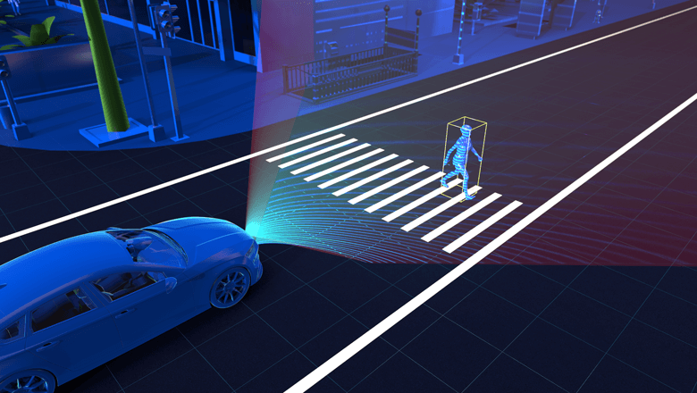
Autonomous driving with lidar
Various car manufacturers, Google, and Intel are currently developing self-driving cars. According to account manager Ad, each manufacturer or developer has its own preference for technological tools.
“This is how Tesla uses radar, while Google combines lidar and radar. Intel, on the other hand, relies entirely on camera technology. What all manufacturers have in common is that they combine visual (camera) images with sensor information.”
“The combination is necessary to ensure safety and reliability under all circumstances. If one technology fails due to a malfunction, the other technology will still detect and intervene to switch to a safe mode,” said the account manager.
In this industry, lidar is used for object detection and distance measurement around the vehicle. Mulders: “This includes vehicles in the broadest sense of the word. Lidar is also used in self-driving forklifts in warehouses, agricultural machinery, and so on.”
Lidar evolution – smaller and cheaper
The high cost and size of lidar systems were a barrier to commercial application in self-driving vehicles. According to the renowned weekly magazine The Economist a commercial lidar system in 2016 could still cost around $50,000.
This has changed. Various sensor manufacturers, such as Velodyne, Infineon, and LeddarTech, are currently developing and producing smaller and much cheaper lidar sensors. Thanks to advanced and increasingly affordable chip technology.
All sensory components (laser, optics, and processing) can therefore be fabricated at the chip level. Aspheric lenses eliminate the need for moving mirrors to spread the light widely.
Lidar sensor manufacturers
Infineon is working on a miniature system: MEMS lidar, which contains a micro-electro-mechanical (MEMS) mirror. This advanced mini-mirror was invented by the Dutch company Innolucence. A MEMS lidar sensor – with a range of 250 meters and a scanning capacity of 5000 measurement points per second – is expected to cost no more than $250.
Velodyne announced a compact solid-state lidar sensor for autonomous vehicles in early 2021. LeddarTech is at the forefront of solid-state lidar technology and has already launched a compact lidar system on the market: LeddarVU. The complete sensor weighs only 107 grams.
LeddarTech: Leader in Solid-State Lidar
Sentech applies LeddarTech's solid-state lidar in autonomous mobility applications for various clients. “For example, in the field of agri-tech,” says Ad. “We use LeddarTech's sensor technology for agricultural AGVs.”
According to the account manager, the Canadian sensor manufacturer is at the forefront of solid-state lidar. “A major technical advantage is the absence of moving parts. This makes the sensor more robust and suitable for extreme conditions.”
“Another big advantage for us is that this manufacturer supplies modules, allowing us to develop custom sensor applications,” says Mulders.
In a white paper on lidar technology, LeddarTech describes how it approaches detection and ranging in an innovative way.
Sensor fusion – advantages of combining lidar and radar
Radar can detect at greater distances and can see through barriers. “That's why radar is interesting for agricultural vehicles because it can detect the soil through crops,” explains Ad.
In contrast, lidar offers a wider field of view and greater resolution, and can better determine the size and shape of objects.
Mulders: “That's why at Sentech, we work on sensor fusion will combine lidar and radar in one integrated sensor application. This way, we can leverage the advantages of both sensor technologies, so that their individual disadvantages are nullified.”
More about self-driving vehicles
Lidar is in the spotlight as a technology for self-driving vehicles. Sentech is also busy with further development, together with Velodyne, LeddarTech, and other sensor manufacturers.
Do you want to know how sensor technology enables autonomous driving? rapids brings?
In the defense sector, the field is not a forgiving environment. From sand and dust to rain and extreme heat, only robust sensor technologies like lidar, radar, and high-quality encoders provide accurate and reliable measurements, enabling vehicles and drones to perform their tasks safely and dependably.
Lidar, radar, and encoders each offer unique advantages depending on the application, from autonomous navigation and distance measurements to angle and position measurement. Below, we discuss the features and applications of these technologies in defense applications.
Lidar: Measuring Distances for Autonomous Movement
Lidar uses laser pulses to measure distances to objects. The technology creates a 3D point cloud of the environment, enabling autonomous navigation. Lidar systems are widely used in autonomous aerial, maritime, and ground vehicles, such as mine detection robots.
Lidar is very accurate and performs well in varying light and weather conditions. There are rotating variants with a 360-degree view and compact solid-state lidars without moving parts, making them more resistant to wear and tear.
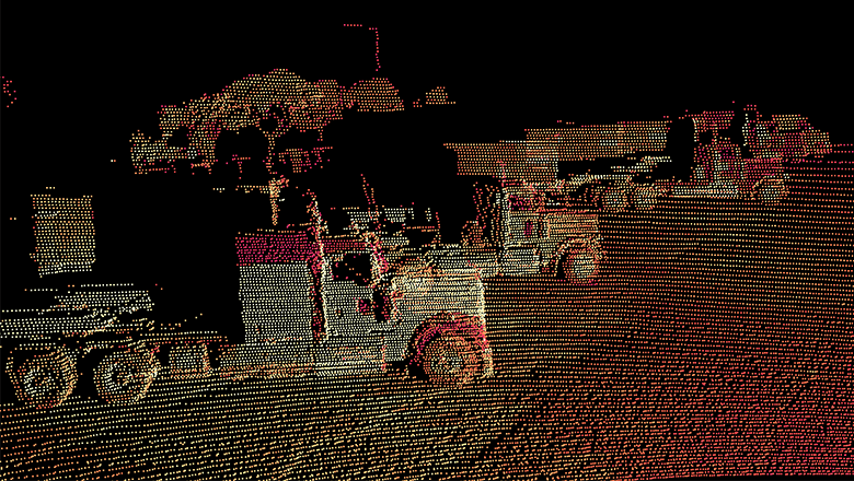
A 3D point cloud says more than a thousand words. This is the output of lidar.
Radar: measuring distances and levels
Radar sensors measure distance, speed, and level using radio waves. Thanks to the high penetration power of radar signals, radars can see through plastics. This makes the modules easy to install and usable in harsh and rough conditions. Weather influences and contamination do not affect the measurement results.
Radar sensors are very well suited for defense applications and the specific challenges of that sector. They are used not only for speed and distance measurements, but also for level measurements in silos and tanks, for example.
Encoders: position and angle measurement
Encoders measure the position, speed, and direction of a moving object. They are available in various technologies. For position and angle measurements, inductive and capacitive encoders are most suitable. They measure contactlessly, are insensitive to contamination, and meet the EMC requirements of the defense market.
Inductive encoders work with electromagnetic induction and are particularly robust. Capacitive variants measure with high resolution and are easily shielded within a housing – ideal for harsh environments.
The question is not if, but when fully autonomous driving will arrive on public roads. The latest Teslas can already do it, and Automated Guided Vehicles (AGVs) are commonplace. The vehicles of the future will combine advanced technologies. Here, you can read about which sensor technologies these are and what their advantages and disadvantages are.
A pilotless airplane or a driverless bus is possible in the foreseeable future. Only legal and psychological objections stand in our way; just as the steam locomotive caused controversy and challenges in the 19th century.
“Cameras and various types of sensors in fused sensor applications are the eyes and ears of the future drivers of our cars,” predicts business development manager Marco Leeggangers.
The evolution of autonomous movement
Autonomous driving was one of the main themes at the IAA Frankfurt this year. The automotive industry is working on technologies that enable completely autonomous movement in public spaces.
The automotive world uses a Scale level from 0 to 5. Level 5 for a fully automated car ride, while you read a book or watch a movie.
According to Leeggangers, all new car models must be automated at level 2 from 2018 onwards to receive a 4- or 5-star safety rating. “The car will then be equipped with Advanced Driver Assistance Systems (ADAS). Such as Automatic Emergency Breaking, Lane Assistance, and Road Edge Detection.”
Tesla has made the leap from ADAS to autonomous in its latest models. The latest version of Tesla's Autopilot is already balancing on the border of level 4 and 5.
Business applications: AGVs
Businesses have long been using autonomously guided vehicles (AGVs) for distribution applications in particular. In many distribution centers, automatic forklifts operate, and order picking is done by robots.
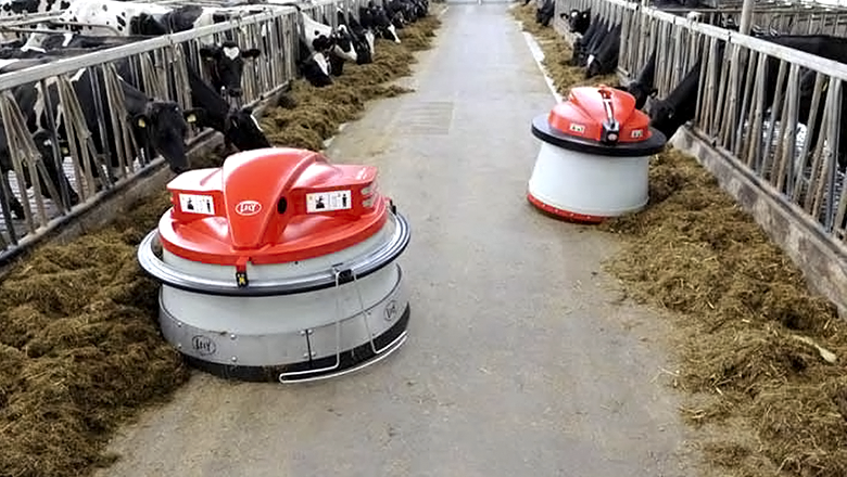
The Netherlands leads in innovation in Agricultural and horticultural automation met UAV's (drones) and AGV's (robots for cleaning stables, feeding livestock, and performing logistical tasks in greenhouses).
Why do we want self-driving vehicles?
Idlers: “In my eyes, this is a logical consequence of technological evolution. Actually, autonomous driving fits with the digital revolution because large amounts of sensor data need to be processed to react independently to the environment. Moreover, the self-driving car is part of the Internet of Things (IoT).”
The benefits of autonomous vehicles are numerous:
- Positive impact on traffic safety. Advanced computers can perform human tasks more efficiently, better, and safer.
- Better utilization of road capacity. Self-driving vehicles drive at shorter distances from each other. This allows them to utilize road capacity more efficiently, reducing and even preventing traffic jams.
- Improved car-sharing opportunities. The use of the self-driving car can be planned so that we can share it. The car for commuting can be available for someone else during the day. Autonomous driving will boost the predicted sharing economy.
- Sustainability: AGVs perform their tasks more efficiently than humans and save raw materials and energy in various industries.
- Productivity: An AGV never gets tired, can handle heavier tasks, and operates flawlessly.
- Cost savings: AGVs enable the full automation of distribution processes. Mobile robots also help reduce costs in agriculture and horticulture.
Detection challenges for distance measurement and positioning
To enable a vehicle to drive autonomously, it needs a comprehensive view of its surroundings. There are four detection challenges for dynamically generating an environmental model.
- 1. Determining the clear passing space on the road surface.
- Determining the geographical route via the navigable space.
- 3. Detecting moving objects (other road users and moving obstacles).
- 4. Recognizing and interpreting road signage, such as traffic signs, traffic lights, road markings, and other visual cues.
Sensor technology has advanced so much nowadays that there are solutions for all detection challenges.
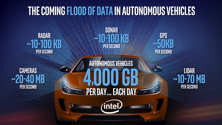
Detection tools for autonomous vehicles
For autonomous driving and advanced driver-assistance systems, primarily radar, lidar, and sonar sensors applied. Combined with cameras and GPS, a vehicle thus dynamically scans its environment. Smart software processes the large amount of data, allowing it to always know its position relative to objects.
These techniques are possible because processors have become increasingly powerful and smaller.
Sensor technology development
Leeggangers indicates that Sentech plays a role in the development and R&D of sensor technology for AGVs. “For example, we already use radar, lidar, and ultrasonics in distance sensors and orientation sensors. As an independent sensor integrator, we are now working on integrating radar and lidar into compact ‘fused’ sensor applications.”
According to the Business Development Manager, sensor fusion leads to smarter and better customer applications, specifically in the area of autonomous movement.
Pros and cons of sensor techniques
The most promising sensor technologies for self-driving vehicles are lidar and radar. Lidar scans the environment with light (laser or infrared), while radar does so with radio waves. “The development of lidar and radar is progressing very rapidly. This is because processor chips are getting smaller and the technology has become more affordable,” according to Leeggangers.
Lidar has significant advantages in remote sensing. One of these is its high resolution, which is necessary for accurately detecting stationary and moving objects. On the other hand, weather conditions like fog and rain have a greater negative impact on accuracy. “Lidar is suitable for observing moving objects in the immediate vicinity of a vehicle,” explains Leeggangers.
Radar can see further, but as the distance increases, accuracy decreases. Therefore, according to him, radar is more suitable for remotely detecting moving objects in front of the vehicle.
The future of self-driving vehicles
“What's special is that the technological visions of car manufacturers differ. One prefers lidar, another prefers radar. The car manufacturers have a sensor-based system as a common starting point. We see a future with advanced fusion sensors in integrated sensor applications,” says Leeggangers.
He also sees new players on the autonomous driving market with a different technological approach, such as Google and Intel. Google has developed its own 3D technology, based on route information and 3D maps.
Intel, the processor manufacturer, has entered the autonomous driving market with the acquisition of Mobileye. The technology concern expects its first self-driving car on public roads in 2021. Intel uses the most advanced visual technology (cameras and software) in vehicles for environmental perception.
However, Leeggangers expects sensors to remain critical links in autonomous driving technology. “You will always need redundant sensor systems to supplement camera or GPS systems. No matter how advanced, anything can break. Redundancy will therefore become increasingly important as the fleet evolves toward full autonomy and driverless traffic.”
More about the development of lidar and radar
Sentech is focusing heavily on the further development of lidar and radar sensors, with an emphasis on sensor fusion. These are the most suitable sensor solutions for autonomous movement in public spaces and business environments.
Sensor fusion is the ultimate form of integration and enables next-generation automotive applications.
Read more about it and let yourself in good direction send.
Sentech has entered into a collaboration with lidar specialist Velodyne. This American company delivers smart lidar solutions. You can find this technology in AGVs, driver assistance, delivery, robotics, navigation, and mapping, among other applications.
Velodyne is a market leader and is globally known for its portfolio of groundbreaking lidar sensors. Her product line consists of a broad package of sensor solutions. These include the cost-effective Puck, the versatile Ultra Puck, the autonomy-enhancing Alpha Prime, and driver assistance software, Vella. In 2022 and 2023, the package will be expanded with solid-state 3D solutions, Velarray and Velabit.
How does lidar work?
Lidar stands for ‘LIght Detection And Ranging’. This technology uses laser beams to create a point cloud — a 3D representation — of the environment. Lidar delivers strong performance in a wide variety of lighting and weather conditions.
A lidar sensor emits pulses of invisible light that reflect off objects in the surroundings. How does the sensor calculate the distance? The sensor uses the time each pulse takes to return to the sensor for this. This is also known as the time-of-flight principle. This process is repeated millions of times per second. This creates an accurate real-time 3D map of the surroundings.
Lidar technology possibilities
Lidar is the only technology that accurately maps the environment and protects the privacy of that environment. Furthermore, the technology is suitable for environments with weather conditions such as rain with its IP69 rating. 3D solid state is available from 2022/2023.
Why partnership
The reasons why Velodyne chose a partnership with Sentech are clear, according to Maria Solovieva, Director of Sales EMEA at Velodyne Lidar. ‘Sentech has an excellent reputation in the market and an extensive customer base in our industry. Their expertise in sensor technologies is impressive. Sentech helps customers integrate the sensor into their application. They even support them in modifying this sensor to save time in the production process. In short; they are an ideal and reliable partner for us.’
With lidar, self-driving vehicles, such as AGVs, can map their surroundings. They scan using light pulses. Despite the simplicity of this optical sensor technology, the technique remains expensive. Developers are innovating to make autonomous driving more affordable, compact, and reliable. This makes this type of transport more accessible to consumers and B2B markets.
Affordable alternatives are entering the market, such as solid-state lidar. Depending on the desired resolution, you determine whether your application requires a basic or a high-end lidar sensor. Furthermore, a sensor alone is not sufficient for autonomous driving. For reliable measurement, you need to combine multiple techniques.
How lidar works
Just as radar works based on radio waves, lidar uses light pulses. When light pulses reach objects or surfaces, detectors capture their reflection. The system calculates how long it took for the light to travel from the laser, via the object, to the sensor. This is converted into distance. All the distances together form a detailed point cloud of the surroundings.
What determines the price of autonomous vehicles?
Self-driving cars, like Google's Waymo, drive autonomously thanks to lidar. The roofs of these vehicles feature a noticeable bulge. This is where the lidar sensor is housed, which the car uses to map its surroundings. For car designers, it's a challenge to inconspicuously integrate the technology into the design.
These lidars are scanning electromechanical systems, consisting of many moving parts. This makes them difficult to produce and miniaturize, causing the price to barely decrease.
At Velodyne, you pay $75,000 for a lidar module. Even simpler technologies cost thousands of dollars. Besides this sensor technology, more is needed to make a vehicle drive autonomously. The total price quickly adds up to 100,000 euros.
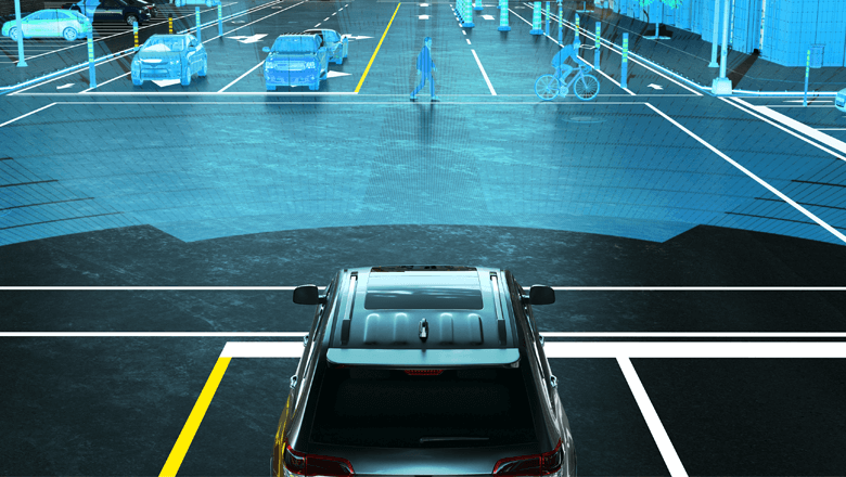
Lidar originally arose from the words ‘light’ and ‘radar’. It is now an acronym for ‘light imaging, detection and ranging’.
Affordable lidar alternative
Solid-state lidar is a smaller and more affordable alternative. Instead of scanned beams, this technique works with broad light flashes. A solid-state laser shoots pulses, which are spread via a diffuser over an angle of 9 to 120 degrees.
The range of solid-state lidar is smaller than that of scanning lidars. However, they are also significantly cheaper. At Canadian LeddarTech, the price for a flash lidar module is around a few hundred dollars. Furthermore, they are much smaller and more robust. This makes them easy and affordable to integrate into vehicles.
Compared to flash, scanning lidar offers several advantages. “If you need high resolution, you should look at high-end lidar sensors,” explains Marco Leeggangers, Operations Director at Sentech. “Furthermore, scanning lidars achieve that higher resolution across their entire 360-degree field of view.”
Adjust range and viewing angle
Lidar manufacturers are not transparent about the frequency and intensity of laser pulses. “During the design phase, you can play around with it to adjust the lidar's range or field of view,” says Olivier Gernier-Lafond of LeddarTech. “With our software, users can adjust various parameters to choose the range and update frequency. This is how we differentiate ourselves from the competition.”
Gernier-Lafond adds: “The wavelength of the laser is approximately 905 nm (nanometers). Many competitors are above 1,000 nanometers. Although lasers around 1550 nm are more powerful, optical components in our wavelength range are more affordable, robust, and reliable. This allows us to deliver cheaper lidar systems. Thanks to our advanced signal processing algorithms, we still achieve the same performance as the competition.”
Noise cancellation in rain and snow
Lidar sensor measurements must be translated into usable data: the perception platform that recognizes and classifies objects. “LeddarTech is exceptionally strong in that translation,’ says Leeggangers. ‘The Canadian signal processing software is very good at noise reduction. Even at night, in rain and snow, it delivers reliable results.’
All detection technologies have their advantages and limitations. Lidar meets in all lighting conditions very accurately the distances. Moreover, this technique can handle both stationary and moving objects perfectly. “Our off-the-shelf systems achieve an accuracy of 5 cm, with a repeatability of 6 mm,” says Vincent Racine, product manager at LeddarTech.
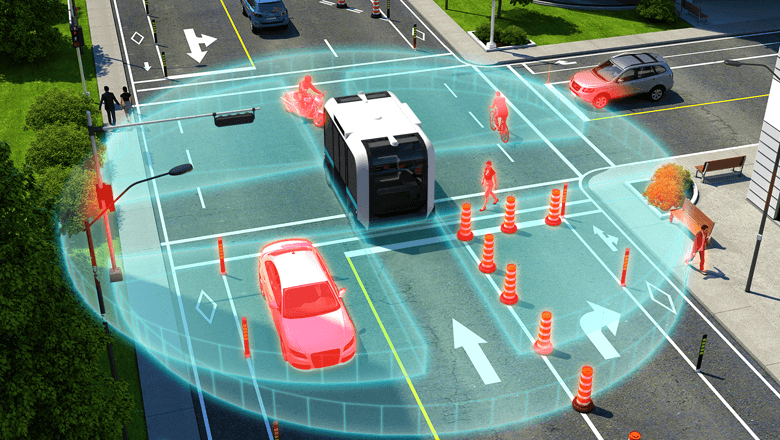
Detecting objects at a great distance
The reflectivity of an object affects detection distance, or its visible range. For example, pedestrians with 10 percent reflectivity are ‘seen’ by LeddarTech lidars up to 200 meters away. Objects with higher reflectivity, such as license plates, are detected at even greater distances. This was successfully demonstrated during CES 2019.
Besides reflectivity, the field of view also depends on the laser's intensity. The more power, the larger the field of view. There are limits to increasing laser intensity, as lasers are used in public areas and should not blind passersby.
Racine adds: “We place a high value on safety. Additionally, we comply with the strict legislation for pulsed lasers. With our software, we ensure that we achieve optimal performance within those limits.”
Combining technologies
Experts agree that you cannot build a fully autonomous vehicle without Lidar. “But it will never succeed with a single sensor type,” emphasizes Leeggangers. “Lidar must be combined with cameras, GPS, and other technologies. Only then will you get reliable measurements.”
Fields of application
Because fully autonomous cars are still mostly research objects for the time being, Leeggangers is looking ahead. “The market for autonomous vehicles is booming. Think of the Second Maasvlakte where carts drive autonomously on a closed site. You also see more and more AGVs in controlled environments like large warehouses and in agriculture.”
In many mobile applications, there are plenty of opportunities for solid-state lidar. “But you can also perfectly use the technology to detect, for example, if drivers are changing lanes in time during a lane closure.’
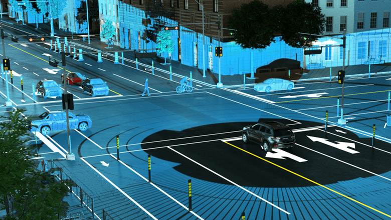
Innovating with lidar
LeddarTech is currently working on several innovations, including various 3D versions. “We started with 2D lidars. They are fine for simple collision detection, for example,” says Racine. “With 3D lidar, you can see more and recognize objects more easily. This technology is now in full development to meet the requirements of automotive and other mobility applications, such as autonomous shuttles and robotaxis.”
Long-range and high-definition 3D lidars are also planned. “Those system-on-chip devices are based on MEMS technology. Although they do have moving parts, they can still be classified as solid-state components. This is also because their dimensions and robustness make them resistant to shocks and vibrations,” according to Racine.
Collaboration for Successful Integration
A few years ago, Sentech signaled the rise of lidar technology. The market wasn't ready for high-end scanning sensors at that time. So, an alternative was sought. In 2016, they discovered LeddarTech's solid-state lidars.
“LeddarTech was looking for a partner who could provide high-level customer support, particularly during development and integration,” says Olivier Gernier-Lafond, Distribution Network Manager at LeddarTech. “We have specialized partners in Germany, France, and Asia, among other regions. The Netherlands has a dynamic market with many innovative companies that we want to connect with.”
Marco Leeggangers of Sentech adds: “Lidars are not simple systems. You always have to integrate them with other hardware and software. They produce an enormous amount of data that you have to translate into usable information with complex algorithms. Sentech can help with that. We can also advise on the position of the sensors and what images that will yield. We often draw on our experience with radar for this, because the technologies and applications are comparable.”
Explore the possibilities of lidar
Where do you start with the integration of lidar? There are various lidar technologies on the market. The speed of the vehicle and the reflectivity of surrounding objects determine the required field of vision. And therefore, which technology is needed to make your vehicle safely drive autonomously.