Lidar is increasingly being used in autonomous systems and robots. The technology makes it possible to perceive the environment in 3D and detect objects accurately. This is valuable for machines that need to navigate, recognize obstacles, or map their surroundings. By looking at applications outside the agricultural market, new ideas emerge on how sensor technology like lidar can add value to agricultural machinery.
Agricultural machinery can navigate more safely, avoid obstacles, and better understand their surroundings with the application of lidar. This also applies to situations with mud, vibrations, and varying light conditions. By learning from applications in other sectors, new ideas emerge for practical lidar applications in agriculture. We utilize robust Ouster lidars, which perform well under harsh conditions.
Challenges in the Agromarket
Sensor integration in agricultural machinery presents a number of typical challenges:
- Dust and dirt
- Strong vibrations, for example, from moving machinery
- Weather influences such as rain, sun, and temperature fluctuations
- Complex and irregular objects, such as crops, bales, or animals
- Dynamic environments, such as with people, animals, or other machines on the farm
Sensors must therefore not only be accurate, but also robust and reliable in harsh conditions. These are precisely the conditions that many autonomous systems in other sectors also have to deal with.
3 practical examples of lidar applications
Example 1: autonomous robots
Trombone develops autonomous electric street sweepers that clean streets independently. For navigation and obstacle detection, these machines use lidar sensors.
The challenges of an autonomous street sweeper overlap with autonomous applications in the agricultural sector. For example, the machine must continue to function reliably in an environment with a lot of airborne dirt, varying weather conditions, and complex objects such as curbs, vehicles, and pedestrians.
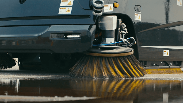
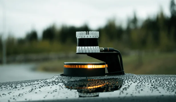
In this application, Ouster's digital lidar continuously creates a 3D image of the surroundings. This allows the machine to detect obstacles and navigate safely.
Because lidar is an active sensor with its own light source, it also works in the dark without additional lighting. In situations with dust or varying light – where cameras struggle – lidar continues to function reliably.
In autonomous agricultural applications, a machine must be able to recognize obstacles, navigate safely around objects, and remain reliably functional in dusty and dirty environments. In agriculture, this translates to, for example, the applications listed below:
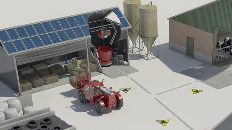
- Feeder robot in a barn, that autonomously drives along fences and feeding places
- Field robot that navigates autonomously between crop rows
Example 2: Autonomous Off-Road Vehicles
Forterra is developing technology that enables defense vehicles to drive autonomously in challenging off-road environments. This includes terrain without lanes, with low visibility, bad weather, and limited GPS. Their systems ensure vehicles remain safe, stable, and reliable under these harsh conditions.
Lidar is one of the most important sensors in Forterra's solutions. It provides a continuous and accurate 3D image of the environment, all around the vehicle. With the digital lidar sensors, distances and obstacles are accurately measured. This allows these autonomous vehicles to drive safely, without lanes or fixed reference points.
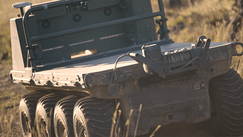
In environments where visibility and GPS are less reliable, LiDAR continues to function well. This allows vehicles to navigate safely in complex and unpredictable situations.
Similar challenges exist in agriculture, such as off-road navigation, changing weather, and pollution. Autonomous solutions help address staff shortages, for example:
- Autonomous tractors
- Unmanned field robots
- Other vehicles that operate autonomously in fields and meadows
Example 3: Mapping with Drones
Deep Forestry develops autonomous inspection drones that scan and map complex environments using lidar.
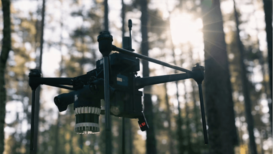
This drone uses an Ouster lidar system to create a 3D map of the forest. The system determines the distance to each tree and surface, thus generating a detailed point cloud of terrain and vegetation.
In agriculture, LiDAR can be used in a similar way as in forestry: it creates a precise 3D image of the terrain and crops, enabling analyses and smart applications, for example for precision agriculture. Examples of agricultural applications include:
- 3D mapping of fields for overview and planning
- Volume measurements of crops or harvested products
- Analysis of terrain structure and vegetation for better crop insights
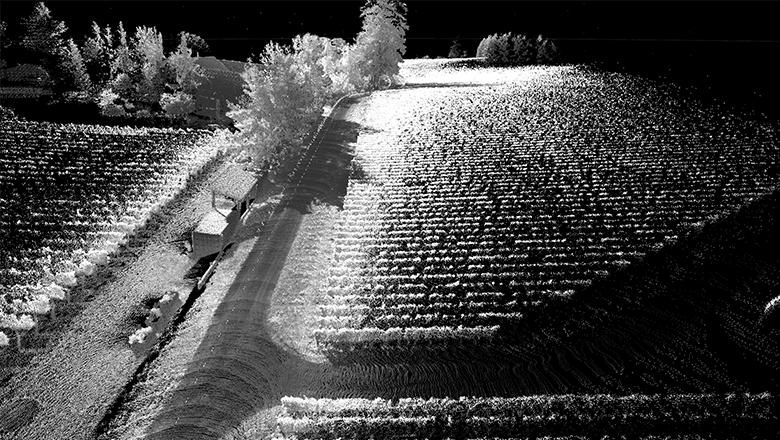
A point cloud image generated by a lidar sensor. The environment is visible as thousands of measurement points that together form a 3D image. This is what lidar ‘sees’: an accurate 3D representation based on distance and reflection. Objects such as walls, vehicles, and obstacles are visible as distinct shapes in the point cloud.
Points to consider during LiDAR integration
For OEMs looking to integrate lidar into agricultural machinery, more is needed than just placing the sensor. Lidar systems offer advantages, but success heavily depends on how they are integrated and how the data is processed. Some key considerations include:
- Mounting position
The sensor's position determines the field of view and potential blind spots. Often, lidars are placed higher on the machine for a better overview of the surroundings. - Dirt protection
Mud and water can affect the optics. Depending on the application, a protective cover, airflow, or cleaning mechanism may be necessary. - Vibrations
Agricultural machinery often produces strong vibrations. Stable mounting and vibration damping help maintain measurement accuracy. - Data processing
Lidar generates large amounts of data. For real-time applications, such as navigation, this data needs to be processed quickly by the right software.
Practical Lidar Integration with Ouster and Sentech
For the integration of digital lidar sensors Shall we work together? with our partner Ouster. Their sensors are the common thread in the practical examples from this blog.
Together, we bring technology into practice: Ouster with the hardware, and Sentech with local support and integration knowledge in the Netherlands. This is how we make the leap from sensor to working solution for machine builders.
Practical Lidar Integration with Ouster and Sentech
For the integration of digital lidar sensors, we are collaborating with our partner Ouster. Their sensors play a central role in all practical examples in this blog.
Together, we turn technology into practical applications: Ouster provides the hardware, and Sentech offers local support and integration expertise in the Netherlands. This way, we help machine builders bridge the gap between sensor and a working solution.