Besides ultrasound and radar, lidar is also increasingly being used for distance measurements and navigation applications in the agricultural sector. Lidar stands for light detection and ranging. Similar to radar, this technology also benefits from extensive miniaturization and integration down to the chip level.
While ultrasound works with sound and radar with radio waves, lidar works with light pulses. The large number of lasers on a chip creates a 3D point cloud of reflections with such high resolution and precision that the environment around the sensor can be mapped to the millimeter.
Lidar in navigation applications
Lidar is regularly used in navigation applications and functions as the eyes of an Automated Guided Vehicle (AGV), such as an autonomous agricultural vehicle. Based on all the reflections measured back by the rotating sensor system, an agricultural vehicle, for example, gets a detailed image of its surroundings, allowing it to navigate across the field and avoid obstacles.
Because lidar is incredibly fast and can also measure while in motion, the technology is suitable for accurately monitoring growth in an orchard with an AGV; useful when pruning automatically. Or, hang a lidar under a drone and map the crops from above. Although lidar's light pulses penetrate crops less effectively than radar waves, the point cloud with 5 million data points per second offers a lot of detail for measuring the ground and crop height.
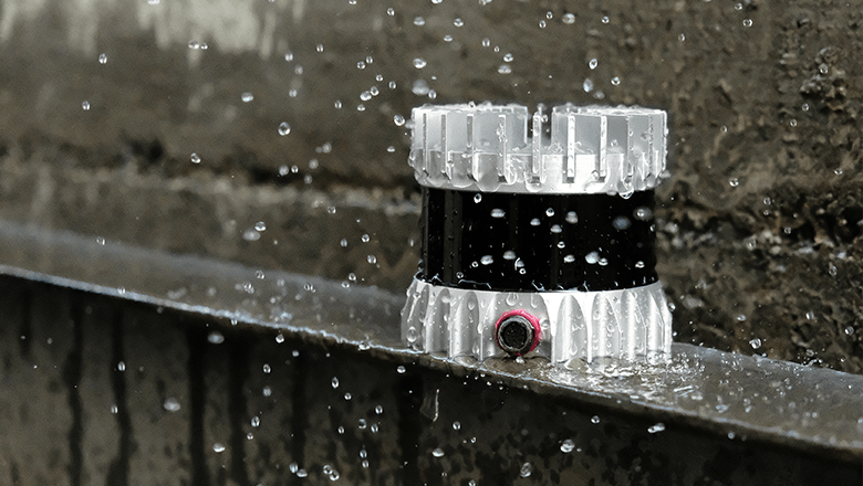
Lidar OS1 from Our technology partner Ouster provides reliable distance measurements, even under rainy and challenging conditions
If you want to measure very accurately
Lidar is much more accurate than radar and suitable for detecting objects, terrain, or crop heights down to the millimeter. It is very resistant to challenging weather conditions, dust and dirt, and very low and very high temperatures. However, lidar is quite expensive compared to radar and ultrasonic.
Examples of lidar applications
- Navigation of autonomous agricultural vehicles
- Mapping crop growth with 3D mapping
Would you like to see more concrete examples of how lidar can be applied in agriculture? In this blog we discuss three practical examples, from autonomous off-road vehicles to drone mapping. You will read how sensor technology in other sectors can offer inspiration for smart agro applications.